I have already written a short introduction to Santorini, as well as a more detailed look at the geology. In this post, however, I wanted to take a more personal look at the island; what my work is about and what it is like to visit these places as a scientist. I also have some pretty photos that I would like to show.
I spent three weeks on the island. The first few days were spent being shown around by my supervisor, getting to know the place and getting to better know volcanic rocks (the most recent volcanic rocks I had seen on my undergrad course were over 30 million years old).
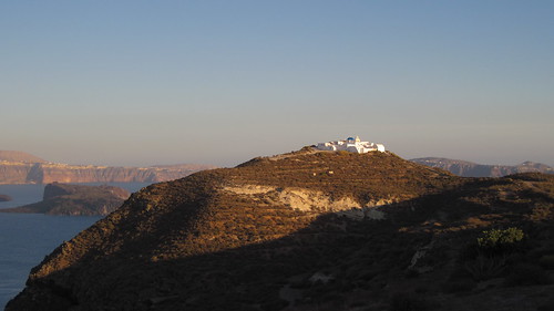
A church on the corner of Therasia, far from the hoards of tourists. In the background the Kameni islands can be seen, and behind that Thera (or the 'mainland').
After the introduction to the volcano, I set off alone to Therasia, the smaller of the two inhabited islands of Therasia. The ferry I got was almost deserted; my only two companions were Greek locals. It was a foretaste of Therasia itself. While Santorini is a major tourist destination, visited by thousands of cruise ship passengers every year, few of them make it over to Therasia. Those that do get off the tourist boat at the foot of Manolas, the biggest village on the island perched overlooking the caldera, rarely make it further than the top of the steps up the cliffs. The peace of Therasia was a welcome contrast to the frantic tourism of Thera (the 'Mainland'), all the more pronounced due to their proximity.
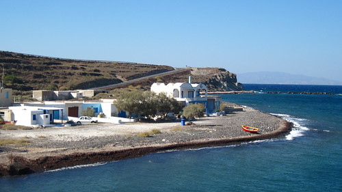
The port of Riva on Therasia, where I disembarked and escaped from the rampant tourism of Thera
After getting there I discovered that the island's one bus, used mainly for shuttling children to and from school, was not working. Luckily, the island's one 'taxi' was functional, so I didn't have a long walk with heavy bags to Manolas and the island's one 'hotel'. After walking through the towns mostly deserted streets from one side to the other, I eventually found the hotel. It was comfortable if a bit basic, a description that could be applied to most of the island.
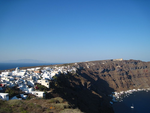
The village of Manolas, from the terrace of the place I stayed on Therasia
That first afternoon was spent doing a little reconnaissance, to work out the best way to access to the cliffs and the rocks I wanted to sample. I cannot stress enough how different Therasia was from the island I could see just across the caldera. Gone where the tourists on quad bikes, or pushing through the crowds to get back to their cruise ship. In their place, two men rode their donkeys back from their field. 'Rural' and 'quaint' were two words that leapt to mind quite regularly.
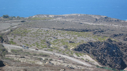
Two men ride their donkeys down a dusty track
The excitement of 'getting off the beaten track' eventually gave way to hunger, at which point I realised I had made an elementary mistake. Despite my place being self-catering, in my eagerness to explore I had neglected to buy any food. I had planned on eating in a restaurant that night, however hadn't factored in the lack of tourists. I headed down the cliffs beneath Manolas, to the place where the tourist boats stop. There were several restaurants there, however beacause the last of the tourist boats had left none of them were still open. Hungry, I climbed back up the cliffs.
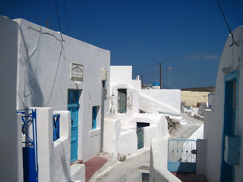
The narrow streets of Manolas, and the (closed) grocery shop. The opening hours were a little unpredictable.
Fortunately, the streets of Manolas that were deserted earlier were now a bit more lively. Vigerous conversations leaked out from the kitchens of the house along the narrow streets. I managed to get directions to a restaurant that was 'probably' open, albeit 45 minutes walk away down unlit roads. So I set off in the dark. The two souvlaki I devoured when I arrived to find it was open tasted better than I thought food ever could... The walk home was all uphill, but I managed to flag down a passing car. Not being an experienced hitchhiker I thought now was as good a time as any to start.
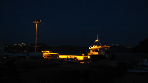
The port of Riva at night, where I eventually managed to find food
The next day the serious fieldwork started. Before I'd left my supervisor we'd hired a boat to take us round the cliffs of Therasia to photograph them. I'd then traced the flows, following each along the cliffs until I knew the relationship between them all. Armed with this knowledge I set out to collect samples from as many of the flows as possible.

The southern cliffs of Therasia, showing the thick sequence of lavas I am working on
Collecting my samples involved much scrambling up and down those cliffs. In the photo above the cliffs are too steep, but in other parts of the island there were small tracks. Just when I would begin to think that were so perilous they could only have been made by goats -- or rabbits even -- I would come across a spent shotgun cartridge. The tranquillity of the island was often broken by the sound of hunters, which was always slightly worrying as I doubt they expected to see a geologist pop up from behind a rock. So, I got out my rucksack's bright orange rain cover and carried on (and survived to tell the tail...)
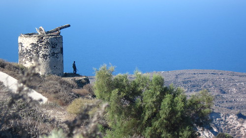
A hunter looks out over the island
The actual work of collecting samples was not easy. The cliffs sheltered me from any breeze while leaving me in the full glare of the sun, the dark rocks absorbing its heat and becoming too hot to sit by the middle of the day. Removing a chunk of rock from the cliff to be analysed with just a hammer is a skill most geologists have to pick up, but it does involve some effort. The bits that break off the most easily tend to be the most altered (by rain or seawater), and so should be avoided. Finding a nice, fresh corner piece and smashing it off is quite satisfying, though.
On the first full day I set out, and managed to find my way down to the bottom of the cliffs in the south. It was only then that I realised that the 2 litres of water I had packed was not going to be enough. Reluctant to waste the effort I had spent getting down there (and the effort I was about to spend getting back up) I carried on collecting samples before turning to go home. The Minoan deposits on Therasia are several tens of metres thick, at along the cliffs they are incised with deep, often vertical gulleys. Some of these would be impossible to climb out of, but I picked one that looked kinder. Its sides were not too steep, and they had even been terraced.
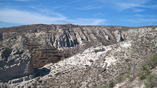
The gulley I climbed out of. I climbed up the far side of the ridge in the foreground.
These terraces were ubiquitous around the island; every available patch of land had been requisitioned for agriculture. The shear effort that must have gone into building them, down steep cliffs in the hot weather, was hugely impressive. However now, aside from a few vines in some of the easier-to-reach fields, they had all been abandoned. The derelict windmill, whose welcome sight told me I had almost made it back after another day in the field, was a reminder that the island's population had once been much larger. It was symptomatic of a larger trend across Greece and much of southern Europe that had taken place, of people moving from struggling to make ends meet in the countryside to the cities. Recently the Greek government has been pumping money into these communities (but for how much longer?), funding more schools, doctors and infrastructure. People had begun to move back, but a sense of abandonment still pervaded much of the island.
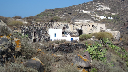
The (mostly) abandoned village of Kera
AS for climbing out over the terraces, they were not as kind to me as they looked. Some of the retaining walls were taller than me, and the bushes that had colonised them where too thick to walk through. After fighting my way through the undergrowth and struggling up the steep slopes of the gulley, I eventually made it to the top of a ridge which I could follow back to the track and home to a nice cold bottle of water.
The rest of the of the trip was fairly uneventful. I collected over 60kg of rocks to send back (many more didn't make it further than the hotel). I also got the chance to attend a part of a conference taking place at the time (although my PhD was confirmed too late to register for it, so I had to sneak in...). Since getting back, my work has mainly been on analysing these samples, mapping out changes in their composition with time and trying to come up with explanations for these. In a few months I get to go back, this time looking for (among other things) charcoal caught beneath the lava flows. If I find charcoal it can be carbon-dated, giving me a much better idea of the age of these lavas, and the timescales that the compositional changes I've found took place over. I am actually really looking forward to going back. Despite the isolation, or perhaps because of the isolation, it is a really beautiful part of the world.
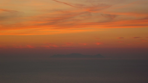
If you liked these photos, I have more (some more geological than others) in my Flickr set.


Comments