As sea ice begins to melt back toward its late September minimum, it is being watched by researchers who have put sensors on and under ice in the Beaufort Sea.
The international effort hopes to figure out the physics of the ice edge in order to better understand and predict open water in Arctic seas.
"This has never been done at this level, over such a large area and for such a long period of time," said principal investigator Craig Lee, an oceanographer at the University of Washington's Applied Physics Laboratory. "We're really trying to resolve the physics over the course of an entire melt season."
The Marginal Ice Zone project is funded by the U.S. Office of Naval Research and will look at whether the processes that drive sea ice melt will change with increasing open water to the south. For example, open water absorbs more solar radiation, which can lead to more ice melt. Open water also exposes the ocean to wind and waves, which could lead to more mixing that would bring warmer, deeper water up into contact with the ice.
Observations will show how much the open water allows surface waves to grow and break up the ice, or how winds blowing across open water or broken ice could churn up the water lower down. They also will study how deep the sun's heat penetrates, how weather and currents affect the ice, and what all this means for the growth of tiny plants and animals living in the ice.

Sensors installed in the Arctic Ocean. Weather stations (green) sit on the ice. Ice-tethered buoys (yellow boxes) take measurements under the ice. Wave sensors (red) sit on the ice and in open water. Swimming robots (yellow) can travel in open water and below the ice, where they navigate using sound sources (gray boxes). Credit: UW Applied Physics Laboratory
"As there is more and more open water in the summer, the processes that control the evolution of the sea ice are changing," said Luc Rainville, an oceanographer at the University of Washington Applied Physics Laboratory.
"Increased open water likely means more wind-driven mixing," Rainville said. "Similarly surface waves will be able to travel further in open water, gaining height and power. Once these waves meet the ice they contribute to breaking the ice edge."
The study's focus is the marginal ice zone, the region between the solid ice and the open water, which is just now beginning to form along the coast of northern Alaska and Canada.
In March, when the ice was thick enough to land aircraft, researchers installed four groups of sensors on the ice in a line that stretched nearly 200 miles to the north. Each site includes instruments to measure the atmosphere, ice and ocean. The line is designed to continuously measure the moving target of the marginal ice zone, with southern instruments melting out and the northern ones taking their place. Ocean sensors that move up and down will measure conditions under the ice.
In late July, after the ice edge recedes to expose the first open water along Alaska's north coast, researchers will release four robotic gliders. These gliders, developed by the UW Applied Physics Laboratory, will navigate using GPS in open water and from acoustic beacons suspended from the ice when under ice. When a glider pops up to the surface, researchers can download the data and send new commands from shore – for example, direct gliders to monitor the effects of a big incoming storm, or investigate a region that's melting quickly. Another instrument developed at the UW, the SWIFT float, will take precise measurements of surface waves.
Lee will join the Korean icebreaker in August to place a fifth set of instruments and to study how chemistry and temperature affect microscopic marine organisms living in the ice.
Meanwhile, a team from the University of Miami is taking high-resolution satellite pictures of the ice floes that researchers will combine with the other observations.
"This field program will provide unique insight into the processes driving the summer melt of Arctic ice," Lee said. "It's the automation and unprecedented collaboration that allows us to be out there for the entire season," he said. "You couldn't afford to be out there at this intensity, for this length of time, any other way."

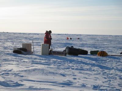
A scientist assembles an ice-tethered water profiler on the ice in March. The instrument is now anchored in a hole in the sea ice, with a moving piece to measure the water properties below. Credit: M. Ohmart, Univ. of Washington


Comments