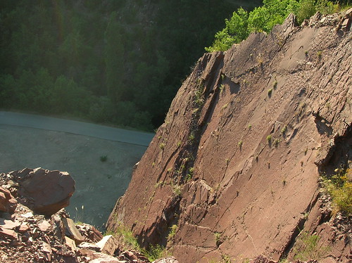
For the first photo, I have these ripple marks. They are in some Triassic sandstone, found in an abandoned quarry. A lot of geology is done in abandoned quarries. I hadn't quite expected to get up where I did. I was following a cutting alongside an overgrown track, and had to push my way through a particularly thick patch of brambles before I found myself at the top of this cliff.

Anyway, in the picture you should be able to make out ripples on the flat surface (click to see it larger, on Flickr). These ripples would have been formed at the bottom of a river, or somewhere similar, and would originally been on flat-lying beds. However, in the picture the beds are almost vertical. This is a simple but graphic demonstration of the power of plate tectonics, the solid rock was bent and rotated into the position they are found in today. These were deformed during the formation of the Pyrenees.


Comments